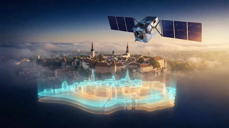
A fever seen from orbit
In late June 2026, as a heatwave settled over Belgium, a satellite passing about 800 kilometers overhead took Brussels' temperature. The image it sent back looked like a medical scan. The dense city center glowed hot. The parks and forests around it showed up as cool islands of green and blue [1].
Nobody on the ground needed a satellite to know it was hot. What the satellite added was a map: precise, citywide and impartial, showing exactly where the heat was trapped and where it was not.
That is the quiet revolution of Earth observation. Satellites have become a mirror in which cities can see themselves as a whole: their heat, their ground, their growth. The next step is to turn that mirror into a crystal ball, a digital twin that does not just show what is happening but simulates what could happen next.
Cities flying partly blind
More than half of humanity now lives in cities and the share keeps rising [2]. Cities are also where climate change bites hardest. Concrete and asphalt soak up the sun by day and release it at night, creating the urban heat island: a pocket of heat that can leave a city center dangerously warmer than the countryside around it. In Europe, heatwaves are arriving earlier, lasting longer and coming more often [1].
Yet many decisions about cities are still made with patchy information. Where should the next trees go? Which neighborhoods overheat at night, when vulnerable people cannot cool down? Is the ground beneath a new railway line slowly sinking? Where will flooding strike if a storm stalls overhead?
The answers are often scattered across separate departments, inconsistent sensors and maps that are years out of date. A council can measure the temperature at a handful of weather stations. It cannot easily measure every street.
This is the gap space technology is starting to fill. From orbit, a city can be measured all at once, the same way every time and across borders. Many European cities face a 2030 deadline under the EU's mission for climate-neutral and smart cities [1], so that consistency is becoming a practical necessity rather than a scientific luxury.
What the mirror already shows
Europe's Copernicus program, with its fleet of Sentinel satellites and free data, has turned several of these questions into maps:
- Heat, street by street. A study using satellite temperature data across nearly 300 European cities found that tree-covered areas during summer heat extremes ran up to 4 °C cooler than dense urban districts in southern Europe and as much as 8 to 12 °C cooler in central Europe. EU-funded projects are now helping cities feed such satellite products directly into their planning [1].
- Ground that moves. Since 2022, the European Ground Motion Service has used radar from the Sentinel-1 satellites to measure ground movement across Europe with millimeter precision [4]. Updated every year, it lets authorities watch for sinking ground beneath dams, bridges, railways and buildings and helps planners avoid building on unstable land [3].
- A digital twin of the Earth. Destination Earth, an EU initiative launched in 2022, aims to build a digital replica of the Earth system by 2030 [6]. Its first two twins, one for climate adaptation and one for extreme weather, run on Europe's supercomputers. Its third phase runs from June 2026 to June 2028 and adds work to turn the twins' output into high-quality data for AI [5].
- Night vision on the way. The heat island is at its worst at night, a gap in today's coverage. ESA's planned Land Surface Temperature Monitoring mission, two satellites due to launch from 2028, will map surface temperatures at about 50-meter resolution, including the night-time data that urban planners most need [7][8].
Taken together, satellites now offer cities something they never had before: a consistent, continent-wide health check that can be repeated as often as the satellites pass.
The zoom problem
Here is the catch and it is a fascinating one. The planet and the city work at very different scales.
A showcase simulation from Destination Earth models the whole globe's clouds at a resolution of 5 kilometers [9]. That is a remarkable feat for a planetary model. But a single 5-kilometer square can contain a park, a motorway, a hospital and a thousand homes. A city planner deciding where to plant fifty trees needs to know which side of the street bakes in the afternoon. That is a question asked at the scale of meters, not kilometers.
There is a second subtlety. Thermal satellites measure the temperature of surfaces: roofs, roads, treetops. What harms people is the temperature of the air they breathe and the heat that radiates at them as they walk. The two are related, but they are not the same and converting one into the other takes local measurements and careful modeling.
So a planet twin cannot simply be zoomed in like a photo. Between orbit and the street there needs to be another layer: a city twin that blends satellite data with building outlines, local sensors and traffic patterns. Researchers are already exploring AI models that sharpen coarse satellite heat maps to finer detail and predict how much heat a neighborhood holds overnight [10].
The future of urban digital twins is therefore not one giant model but a stack of them, each passing information to the next.
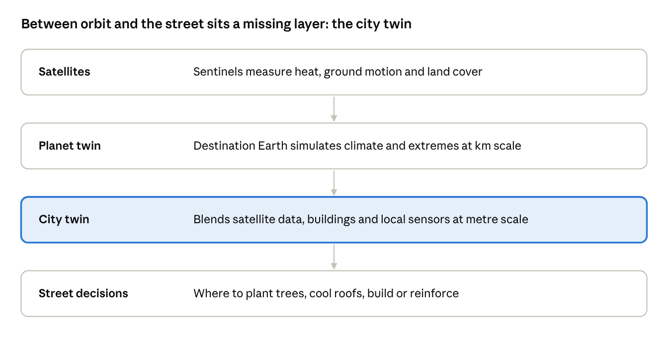
Each layer sharpens the one above it; the city twin is the layer still being built.
Imagined futures
1. The heat-aware swap station. The previous articles in this series imagined swap stations as grid batteries. Now picture planners using a city twin to decide where to put them. Batteries age faster in heat, so the twin flags sites that bake in summer and steers stations toward shaded, cooler ground. It could even suggest green roofs on top of the stations, so they cool the street around them.
2. A rehearsal for every heatwave. Imagine a city running next week's forecast heatwave through its twin before it arrives. The simulation shows which care homes will overheat at 2 a.m., which tram lines will buckle and where the power grid will strain under air conditioning. Cooling centers open, buses reroute and grid operators line up stored energy before the first hot night.
3. Planting by prescription. Instead of planting trees where there happens to be space, picture a twin that prescribes them like medicine: this species, this street, this side, for this much cooling at night. Ten years later, satellites check whether the prescription worked and the twin learns from the result.
4. The ground remembers. Millimeter radar maps already show where ground is moving. Imagine them combined with a city's records of pipes, cables and foundations, so the twin warns a water company that a main is under stress months before it bursts. Maintenance would become a matter of foresight instead of emergency repair.
5. The twin you can talk to. Today, digital twins are tools for specialists. Picture a version any resident could query in plain language: "How hot will my street get this summer and what would two more trees change?" Climate adaptation would become a conversation with the city, not a report on a shelf.
Looking back at ourselves
There is something poetic about it. Humanity spent centuries looking up at the sky, wondering what was out there. Now some of our most useful instruments in space are pointed the other way, looking back at us.
What they show is not always flattering: the hot gray cores of our cities, the ground sinking beneath our buildings, the places we forgot to leave room for trees. But a mirror is only uncomfortable if you refuse to act on what it shows.
The satellites already exist. The planetary twin is running. The missing piece is the layer in between, the city twin that turns a view from orbit into a choice on a street corner. Building it will take AI, local sensors and the computing power described elsewhere in this series. Above all, it will take cities willing to look in the mirror and change what they see.
References
The scenarios in "Imagined futures" are the author's speculation and are not drawn from any source. The diagram is an original illustration.
- European Health and Digital Executive Agency (HaDEA). Satellites can help cool Europe's cities. 26 June 2026.
- European Space Agency. Sensing city night heat from space.
- Copernicus Land Monitoring Service. European Ground Motion Service.
- BELSPO Earth Observation. Mapping ground motion at European scale: from dream to reality.
- ECMWF. Destination Earth to move into third phase. ECMWF Newsletter 187, 2026.
- Destination Earth. Phase three of Destination Earth confirmed. 1 February 2026.
- European Space Agency. Sensing city night heat from space (LSTM mission and night-time data).
- ESA. Copernicus Land Surface Temperature Monitoring (LSTM) mission overview.
- ECMWF. Third phase of Destination Earth confirmed. 2026.
- Eötvös Loránd University (ELTE). Urban Heat Island and Green Infrastructure Potential Mapping.