When the map starts lying
A passenger jet cruises over the Baltic Sea on a clear night. On the flight deck, an alarm chimes. The GPS position on the screen jumps abruptly, placing the aircraft somewhere it plainly is not. The pilots exchange a glance they have learned over the past few years. This is not a malfunction. Somebody is interfering with the signal.
For most of us, GPS is invisible magic: the blue dot that never gets lost. For pilots, ship captains and, increasingly, the makers of self-driving cars and drones, that blue dot has become a vulnerability.
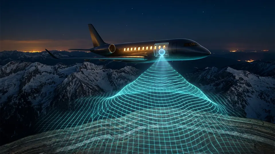
So engineers are reaching for a very different idea. Instead of listening to satellites 20,000 kilometers away, what if a vehicle could navigate by feeling the faint magnetic and gravitational fingerprints of the rocks beneath it? To do that, you need sensors of almost absurd sensitivity and that is where quantum physics comes in.
A fragile blue dot
Satellite navigation signals arrive at Earth astonishingly weak, which makes them easy to drown out (jamming) or to fake (spoofing). Both are now routine around Europe's eastern edge.
- In Lithuania, pilots reported 169 GPS jamming incidents in January 2026 alone. The national regulator says interference is recorded constantly and it estimates that more than 30 jamming sources may have operated in Kaliningrad and the Baltic Sea during 2025 [1].
- On the Danish island of Bornholm, a monitoring station logged 30 jamming and spoofing events in the first part of 2026, compared with 16 in all of 2025. One ship captain described a day in late July with no usable signal between Gdańsk and Gotland [2].
- Authorities in the region link much of the interference to Russian electronic warfare, which has intensified since the full-scale invasion of Ukraine [1].
The stakes go beyond getting lost. GPS also distributes precise time, which phone networks, power grids and financial systems quietly rely on. And the vehicles in this series' future (autonomous cars, delivery drones, robotaxis) all assume they know where they are.
The traditional backup is an inertial navigation system: accelerometers and gyroscopes that track every movement from a known starting point. It works without any signal, but small errors add up, so over hours the estimated position drifts further and further from the truth. What navigators need is a way to correct that drift without asking the sky.
Reading the planet's fingerprints
The Earth's crust is not magnetically uniform. Iron-rich rocks, ancient lava flows and buried geological structures all leave a slightly different magnetic signature. Geologists have mapped these magnetic anomalies for decades. If an aircraft can measure the local field precisely enough and compare it with such a map, it can work out where it is. Nobody can jam the rocks.
The difficulty is that these signatures are faint and a vehicle is a noisy magnetic environment full of motors, wiring and metal. Quantum magnetometers, which use atoms whose quantum states shift in response to minute magnetic fields, are sensitive and stable enough to pick the signal out. Here is what they have done so far:
- Four hours over the ocean. In September 2026, Honeywell and the Pentagon's Defense Innovation Unit flew an Embraer 170 from near Seattle to the Gulf of Alaska and back, 4 hours and 23 minutes without GPS, guided by a quantum-sensor magnetic navigation system. Position accuracy was 89% better than conventional backup navigation would have managed [3]. The program, launched in 2024, rests on the fact that the Earth's field cannot be blocked or spoofed [4].
- Beating the gold standard. In published field trials, the Australian company Q-CTRL reported magnetic navigation with up to about 46 times lower positioning error than a strategic-grade inertial system. Its best flight ended within 22 meters of the true position. The same study reported the first magnetic navigation in a ground vehicle using publicly available maps, with errors about seven times lower than inertial navigation alone [5]. The company says its system has since become the first quantum navigation system to reach airworthiness qualification as a GPS backup [3].
- On a drone, in under an hour. Sandbox and Northrop Grumman flight-tested a software-led magnetic navigation system on an expendable drone, using AI to filter out the electromagnetic noise of the drone's own motors in real time [6].
- Navigating by gravity at sea. Trade press reports that in August 2026 Q-CTRL demonstrated GPS-free navigation using quantum gravity sensors aboard an Australian Navy vessel, running continuously for 144 hours [7].
A backup, not a replacement
The headlines can blur two different technologies, so it is worth separating them.
Magnetic navigation is map-matching. It produces a position fix by comparing measurements with a map, much like recognizing a street from its shopfronts. Quantum inertial navigation is something else: it uses clouds of ultra-cold atoms to measure motion with extreme precision, so the drift builds up far more slowly. The September flight over the Pacific was the first kind, not the second [7].
The comparisons matter too. An "89% improvement" was measured against conventional backup navigation, not against GPS [3][7]. When satellites are available, they remain extraordinarily accurate and cheap. The aim of quantum navigation is not to retire GPS but to make sure that losing it is an inconvenience rather than an emergency.
There are practical hurdles as well. Magnetic navigation is only as good as its maps and maps of the crust are far more detailed in some regions than others. Vehicles generate their own magnetic noise, which software must strip out in real time [6]. Cities, packed with steel, power lines and electric trains, are likely to be among the hardest environments of all. Quantum sensors are also still specialist equipment, a long way from the price and size of the GPS chip in a phone.
The real future is a blend: each method covering the others' weaknesses, with software deciding moment by moment which one to trust.
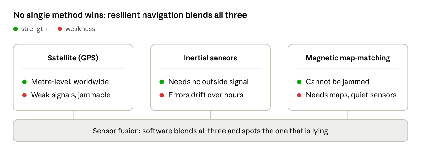
Each method fails differently, which is exactly why combining them works.
Imagined futures
1. The robotaxi that cannot be fooled. Picture a self-driving car that carries a small quantum compass alongside its GPS. When a spoofed signal suddenly insists the car is three streets away, the magnetic reading disagrees, the software flags the lie and the car carries on calmly using its own senses. Spoofing would go from a safety threat to a logged curiosity.
2. Maps that update themselves. Every quantum-equipped vehicle would be a moving survey instrument. Imagine fleets of trucks, trains and swap-station shuttles continuously refining Europe's magnetic and gravity maps as they drive, so the maps that make navigation possible get sharper with every journey, much as the city twins in our previous article grow sharper with every satellite pass.
3. Time from the ground. GPS quietly delivers the time that keeps power grids, telecom networks and trading systems in sync. Picture a network of compact atomic clocks at substations and swap stations, keeping exact time locally for hours or days if satellite signals vanish. The grid described earlier in this series would stay synchronized even under attack.
4. Underground and underwater. Satellite signals cannot reach tunnels, mines or deep water. Quantum navigation, which needs no outside signal, could guide metro trains, mining robots and underwater drones where GPS has never worked at all. The places that were always off the map would finally have one.
5. The chip-sized quantum compass. Today's quantum sensors fill a rack or a pod. The history of electronics suggests they will shrink. Imagine one small and cheap enough to sit in every phone. That would need breakthroughs in exactly the kind of chip manufacturing that underpins every other technology in this series.
The oldest map of all
Long before satellites, navigators found their way by reading nature: the stars, the sun, the swell of the sea, the pull of a magnetized needle. Then GPS arrived and made it all seem quaint. Why read the world when a satellite will simply tell you where you are?
The events over the Baltic have revealed the price of that convenience. A signal from space can be drowned out or faked. The rocks beneath our feet cannot.
There is something fitting in the fact that the most advanced physics we have, the strange behavior of individual atoms, is taking us back to the oldest map of all: the planet itself. The compass, reinvented with quantum mechanics, may once again be the instrument we trust when everything else goes quiet.
References
The opening cockpit scene is illustrative. The scenarios in "Imagined futures" are the author's speculation and are not drawn from any source. The diagram is an original illustration.
- LRT. GPS jamming incidents reported by pilots continue in Lithuania, regulator says. 9 March 2026.
- European Pravda, reporting DR. Denmark records GPS disruptions at record levels near island of Bornholm. 10 August 2026.
- Leeham News and Analysis. Honeywell Tests Magnetic Navigation in GPS-Free Flight. 9 September 2026.
- Executive Gov. DIU MagNav Quantum System Completes GPS-Free Flight Test. 8 September 2026.
- Q-CTRL et al. Quantum-assured magnetic navigation achieves positioning accuracy better than a strategic-grade INS in airborne and ground-based field trials. arXiv:2504.08167, 2025.
- Quantum Computing Report. SandboxAQ and Northrop Grumman Flight-Test AQNav Quantum Navigation on Attritable Drone. 9 September 2026.
- MigFlug. GPS Off for Four Hours: The Jet That Navigated by Rock. 7 September 2026.